René Phelipeau and the Plan de la Plaine du Cap François, 1786

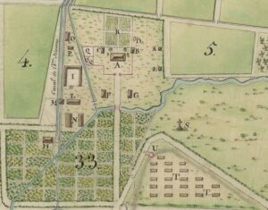
Mary Pedley (William L. Clements Library, University of Michigan) The map entitled Plan de la plaine du Cap François en l’Isle St. Domingue is a fascinating example of cartographic composition and engraving skill (Fig. 1). It combines the measured detail of property surveys, the shaded values of topographical depiction, the soundings and nautical codes of …

Read More

Always Already Colonial: Rose Ducreux in Port-au-Prince

David Pullins (Metropolitan Museum of Art, New York) In June 1802, a well-established Parisian painter, Rose-Adélaïde Ducreux (1761-1802), sketched the disembarkment in Port-au-Prince of the seventy-four-gun Zélé warship that over the past four months had brought her safely from Brest.[1] It was one of forty-five ships that set sail as part of Napoleon’s efforts to …

Read More

Black Geographies of Art in Haiti/Saint-Domingue: A Workshop on Critical Counter Maps and Digital Humanities

Meredith Martin (New York University) Collaboration and conversation are central to our Colonial Networks project. On November 8, 2024, we hosted two workshops at NYU’s Center for the Humanities to discuss, critique, and generate new ideas for two project components that we are currently developing. One of these workshops, which Hannah Williams has written about …

Read More

Unsettling Collections: A Workshop with Museum Curators and Collections Researchers

One of the key collaborative activities of our 2024 program for the Colonial Networks project were two workshops we ran at NYU’s Center for the Humanities on November 8, 2024. This post is about the workshop we titled Unsettling Collections: The Paris Art World and Haiti/Saint-Domingue, which brought together a group of museum curators, scholars, auction house specialists, and collections researchers to imagine new ways of telling stories about French art through digital approaches to provenance histories.

Read More